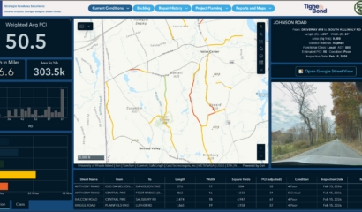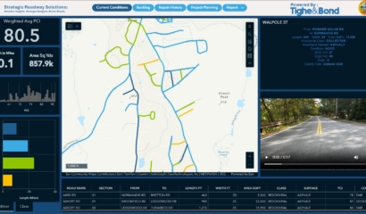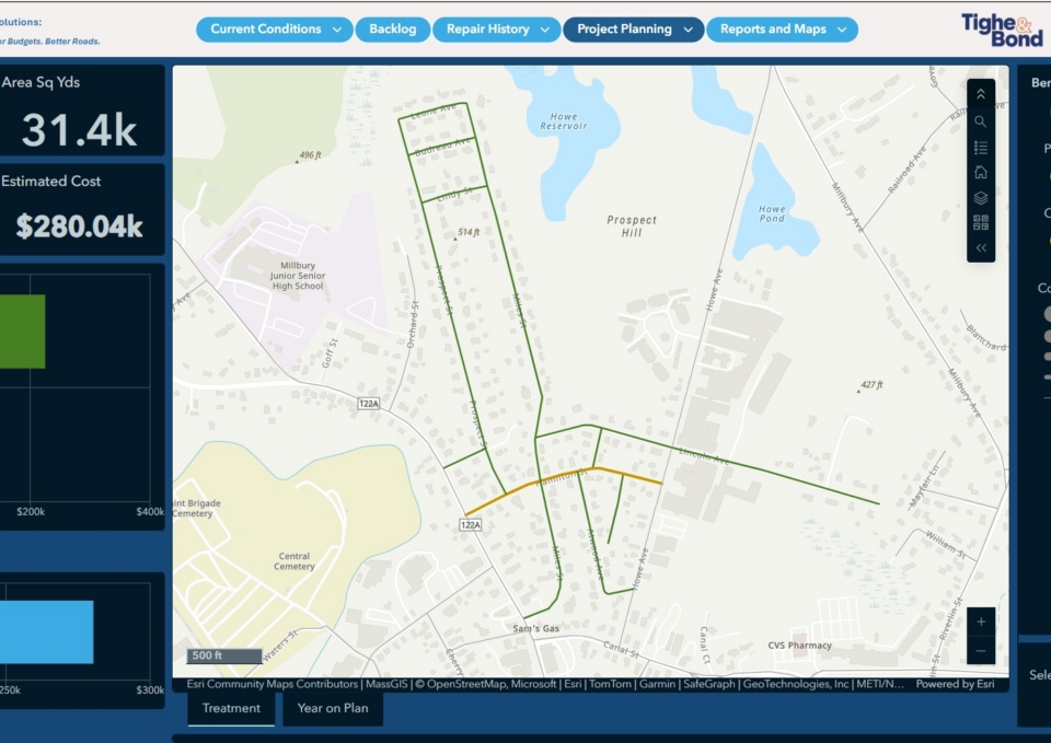
Our team worked with the Town of Millbury, MA to update its pavement management program to reflect current conditions. To support this effort, an ESRI-based geodatabase was developed to serve as the foundation for managing, structuring, and storing pavement condition data. Using advanced LiDAR-based technology, pavement condition field inspections were completed for approximately 72 miles of Town-maintained paved roadways.
Following post-processing, each block-to-block GIS roadway segment was evaluated and assigned an industry-standard Pavement Condition Index (PCI) rating on a scale of 0 to 100. Project deliverables included an online GIS-based platform integrating pavement condition data with geocoded forward-facing and 360-degree imagery via embedded hyperlinks. Together, these deliverables support the Town’s development of its capital improvement plan. Currently, we working with the Town to expand its asset management program through development of a pavement marking inventory and updates to utility infrastructure datasets.