Our Services

Technology & Data

Technology gives us the opportunity to approach what we do from a new perspective. It also enables our clients to unlock greater efficiency, productivity, collaboration, and support to deliver their projects using a wide range of our digital capabilities. These include GIS-based applications to enable cloud-based management of data and assets; digital reality capture capabilities that allow for the rapid scanning of large areas at a high level of detail; as well as 3D modeling, digitally assisted design, and digital data management to operationalize your data for facilities design and management.

Our Services 

Expand All

Asset Management 

At Tighe & Bond, our focus is on the aspects of asset management that drive the decision-making process, risk mitigation, and long-term financial sustainability. We help communities identify and capture what assets they have, the location, the condition, replacement costs, and more.

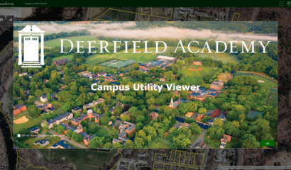
Our data-driven approach to risk-based asset management and capital planning helps our clients maintain the level of service their customers and stakeholders expect. Using our custom GIS-based applications, our clients have easy access to data at their fingertips, improving worker efficiencies, and have the data captured in cloud-based systems to be used in a multitude of ways for local reporting purposes.

Digital Twin 

We work with you to develop a digital strategy that aligns your long-term operational objectives and existing technology solutions with the architecture to develop a centralized data-driven reporting, monitoring, and decision-making platform. Using reality capture and BIM modeling, coupled with secure cloud-based data management, clients can streamline the use of historic and real time data across an organization and throughout an asset’s lifecycle.

Geographic Information Systems (GIS) 

We provide GIS services to help our clients manage their data and assets. This geospatial foundation stores and displays accurate reflections of real-time locations and circumstances, allowing organizations to make better decisions over time. Plus, assembling, analyzing, and managing facility and asset data stored in GIS is more straightforward. This approach directly contributes to the efficiency and cost-effectiveness of many complex projects.

View a story map about our GIS services.

Reality Capture 

Reality capture involves the use of a broad range of data collection techniques to capture a large amount of field data accurately and efficiently, then store that data within a cloud-based application. Our in-house reality capture services include 3D laser scanning, UAV and ROV systems, thermal imagery, and 360° photography. These services capture a “point cloud” of data which can be shared with the client for future use; or converted into meshed surfaces and further developed into 3D models.

UAV/ROV Capabilities 

From taking simple aerial photos to performing structure inspections or creating 3D models, the list of drone capabilities is extensive and continues to expand with advancements in technology. Capitalizing on the power of these drones has practical applications for engineers to manage projects in a way that creates a safe environment and is cost-effective for clients.

  1. ROV Capabilities
  2. UAV Capabilities


SCADA Systems & Automation 

Supervisory control and data acquisition (SCADA) is a centralized supervisory system that monitors and controls devices and equipment at remote facilities. Engineers in our Water Business Line work with operators to provide the required instrumentation, programming, telemetry, and other advanced technologies required.

Visualization & Rendering 

Renderings and visualizations enable our staff to show our clients and project stakeholders a clear picture of what the final product will look like. We can generate renderings throughout the design process, from rough sketches to finely tuned illustrations, working collaboratively with our clients toward effective project solutions. Renderings and visualizations are great tools for engaging the public and building support for a project.

  1. 3D Visualization


Related News & Events