UAV Photogrammetry: A New Tool for Coastal Surveying and Management
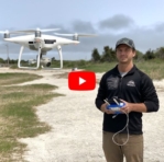
Photogrammetry allows for efficient data collection in hard-to-access or hazardous areas.

Photogrammetry allows for efficient data collection in hard-to-access or hazardous areas.